Happy Birthday: 165 Years of Advertisement Pillar

It’s the advertising pillar’s birthday! The first advertising pillar was installed in Berlin 165 years ago today. The advertising pillar has prevailed – and still shapes the cityscape today. Of course, the advertising pillar is also interesting from a mathematical perspective: In addition to calculating the volume or the surface area of the circular cylinder, […]

It’s the advertising pillar’s birthday! The first advertising pillar was installed in Berlin 165 years ago today. The advertising pillar has prevailed – and still shapes the cityscape today. Of course, the advertising pillar is also interesting from a mathematical perspective: In addition to calculating the volume or the surface area of the circular cylinder, the question of the maximum number of advertising posters can also be asked.

Advertising pillar at the Commerzbank:
How many DIN A0 posters can be attached to the advertising pillar on edge and without overlap? DIN A0: width = 84cm; height = 119cm.

To answer this question, learners have to measure the height and the circumference of the advertising pillar in order to calculate the number of posters. Learners are often surprised by the actual size of the circumference. The height of the advertising pillar is then divided by the height of the poster [number of rows of posters] and the circumference of the pillar by the width of the poster [number of posters per row]. The product of both calculations is the number of posters that can be attached. If the posters may also be hung crosswise, the calculation described must be repeated in order to determine the maximum number beyond doubt.

And now the best: For the advertising pillar task, MathCityMap provides a prepared template, a so-called Wizard Task.

Mathe.Entdecker: Calculating in Constance

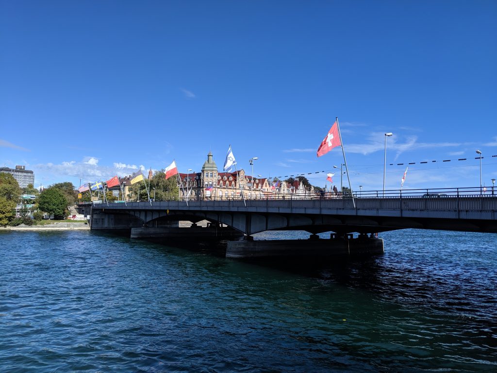
Last October, the MathCityMap team from Frankfurt visited the city of Constance [dt. Konstanz]. At Lake Constance our team is laying out a total of 14 new trails, which will be released today! With the support of the Stiftung Rechnen and the city of Constance we have created many interesting math trails for classes and […]

Last October, the MathCityMap team from Frankfurt visited the city of Constance [dt. Konstanz]. At Lake Constance our team is laying out a total of 14 new trails, which will be released today!

With the support of the Stiftung Rechnen and the city of Constance we have created many interesting math trails for classes and families in the beautiful city of Konstanz. The Mathe.Entdecker trails [engl. Discovering.Maths trails] lead around the harbour, along the Rhine promenade, through the city centre or through the Paradise Quarter. In addition, a “border trail” was created on the German-Swiss border. However, the grand opening with school classes trying out the mathtrails had to be cancelled due to the Corona pandemic. With the following links you can access the articles of Stiftung Rechnen and Marketing und Tourismus Konstanz GmbH about our new math trails.

In the following we list all our created trails in Konstanz. We wish you a lot of fun and success!

Titel incl. Link

Code

Duration| Distance

Konstanz Innenstadttrail
[Around the City of Constance]

672257

2h 10 min | 1.400 m

Konstanz Hafentrail
[Around the Harbour of Constance]

022256

2h 20 min | 1.100 m

Konstanz Grenztrail
[Along the Swiss-German Border]

492255

2h 10 min | 1.700 m

Ein Nachmittag in Konstanz
[An Afternoon in Constance]

352258

4h 20 min | 3.400 m

Mathe für Entdecker – Klasse 3/4
[Discovering Maths – Grade 3/4]

472261

1h 30 min | 1.000 m

Konstanz Familie – Klasse 3/4
[Families in Constance  – Grade 3/4]

452260

2h 50 min | 3.400 m

Mathe am Rhein – Klasse 5/6
[Maths along the Rhine – Grade 3/4]

472262

2h 20 min | 2.200 m

Quer durch Konstanz – Klasse 5/6
[Across Constance – Grade 5/6]

092264

2h 10 min | 1.500 m

Konstanz Familie – Klasse 5/6
[Families in Constance  – Grade 5/6]

562263

3h 00 min | 3.300 m

Mathe im Paradies – Klasse 7/8
[Maths in Paradise – Grade 7/8]

292265

1h 40 min | 1.300 m

Quer durch Konstanz – Klasse 7/8
[Across Constance – Grade 7/8]

072277

2h 10 min | 1.500 m

Mathe am Rhein – Klasse 7/8
[Maths along the Rhine – Grade 7/8]

192276

1h 50 min | 700 m

Mathe am Rhein – Klasse 9/10
[Maths along the Rhine – Grade 9/10]

132259

2h 10 min | 1.400 m

Mathe im Paradies – Klasse 9/10
[Maths in Paradise – Grade 9/10]

132267

2h 40 min | 1.900 m

MathCityMap celebrates the 5,000th user!

Our community is growing rapidly: One week ago, Lorenzo Salucci, a student teacher from Luxembourg, registered as 5,000th user in our portal. All in all (and despite of Corona), we have already welcomed more than 1,000 new users to MCM this year. Our “anniversary user” Lorenzo Salucci gave us an interview about the MathCityMap system […]

Our community is growing rapidly: One week ago, Lorenzo Salucci, a student teacher from Luxembourg, registered as 5,000th user in our portal. All in all (and despite of Corona), we have already welcomed more than 1,000 new users to MCM this year. Our “anniversary user” Lorenzo Salucci gave us an interview about the MathCityMap system which is presented in the following.

Mr. Salucci, you are a student at a Luxembourg university. How did you get in contact with the MathCityMap project? How is it used in the university?

Exactly, I am a student at the Université du Luxembourg and am studying to become a teacher. I came across the MathCityMap project in our mathematics course “Didactics of Mathematics”. In our course, the project is used as a substitute for exams because of the Covid-19 pandemic. We have to create a math trail in small groups near primary schools in Luxembourg. These are then evaluated by our teachers and fellow students.

Have you already had your first practical experience with MCM? What do you expect or promise from the use of MCM in everyday school life?

Personally, I haven’t had the opportunity to do a trail yet, but I plan to try out a math trail in the next few weeks. I believe that the use of an MCM makes it possible to give the students an understanding of mathematics in the outside world. Many people think that mathematics is only taught very theoretically at school. However, the MCM gives you the opportunity to bring applied and realistic tasks as well as other mathematical riddles into real everyday situations.

You have already created your own tasks. What is it about exactly?

Together with two colleagues we have already created our own trail “Mathematik Trail nahe der Scheierhaff-Schule” (engl.: “Math Trail near Scheierhaff School”; Code: 452734). This trail is located on the property of the primary school “Scheierhaff” in Soleuvre, Luxembourg. One task from this trail is located in the playground of the kindergarten, the object of the task is a raised bed. The mathematical topic of this task is the volume. The students have to calculate the volume of this raised bed. One of our teacher’s demands is that we give the pupils two tips on how to solve the task, so we decided to give the children the formula for the volume (volume = length x width x height) and we gave them the hint that 1 meter corresponds to 100 centimeters.

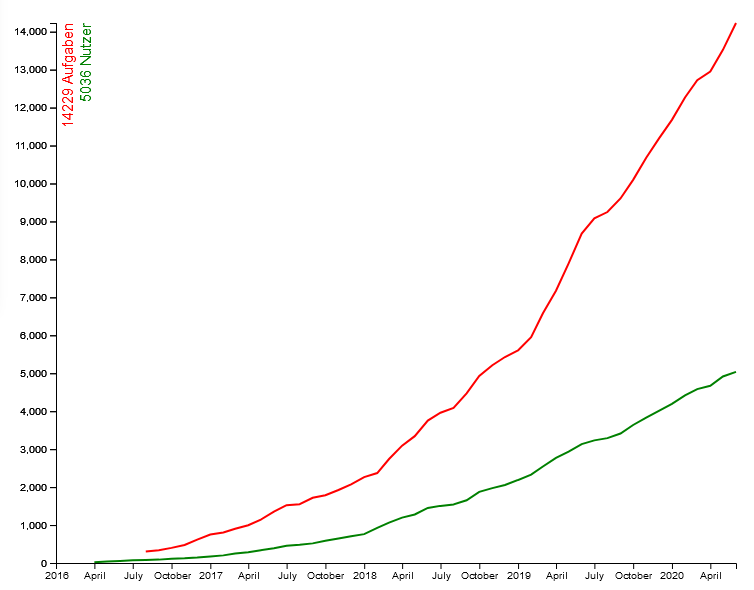
More than 14,000 tasks (red line) have been created by now more than 5,000 users (green line) in the past four years. That’s great! Thanks to all active users of our system!

Proceedings of the ROSETA Conference

We are very pleased to announce the publication of our ROSETA proceedings (Research on Outdoor STEM Education in the digiTal Age) as online open access: https://doi.org/10.37626/GA9783959871440.0 The conference was planned within the framework of our Erasmus+ project MoMaTrE. All MathCityMap related papers in our ROSETA proceedings can be separately downloaded via the added doi-links.   […]

We are very pleased to announce the publication of our ROSETA proceedings (Research on Outdoor STEM Education in the digiTal Age) as online open access: doi.org/10.37626/GA978

The conference was planned within the framework of our Erasmus+ project MoMaTrE. All MathCityMap related papers in our ROSETA proceedings can be separately downloaded via the added doi-links.


MathCityMap related papers in the ROSETA proceedings:

MathCityMap seminar at Goethe University

Despite the Corona crisis, we look forward to working with students to gain exciting insights into extracurricular learning, the use of digital media and the use of MathCityMap. In this video, student teachers of the Goethe University Frankfurt explain what they expect from our MathCityMap seminar in the summer semester 2020. Click here to watch […]

Despite the Corona crisis, we look forward to working with students to gain exciting insights into extracurricular learning, the use of digital media and the use of MathCityMap.

In this video, student teachers of the Goethe University Frankfurt explain what they expect from our MathCityMap seminar in the summer semester 2020.

Click here to watch the video on YouTube!

App Update: We explain the new features!

After launching our new web portal three weeks ago, we now celebrate our new MathCityMap App Update! In the following we present the new features: New features: Our onboarding introduces the system with just a few clicks: With the help of our explanations the start into the world of MathCityMap is now even easier (photo […]

GeneralPatch Notes

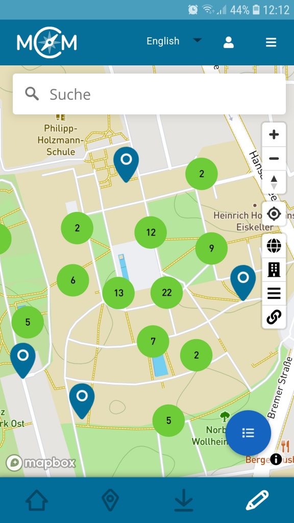
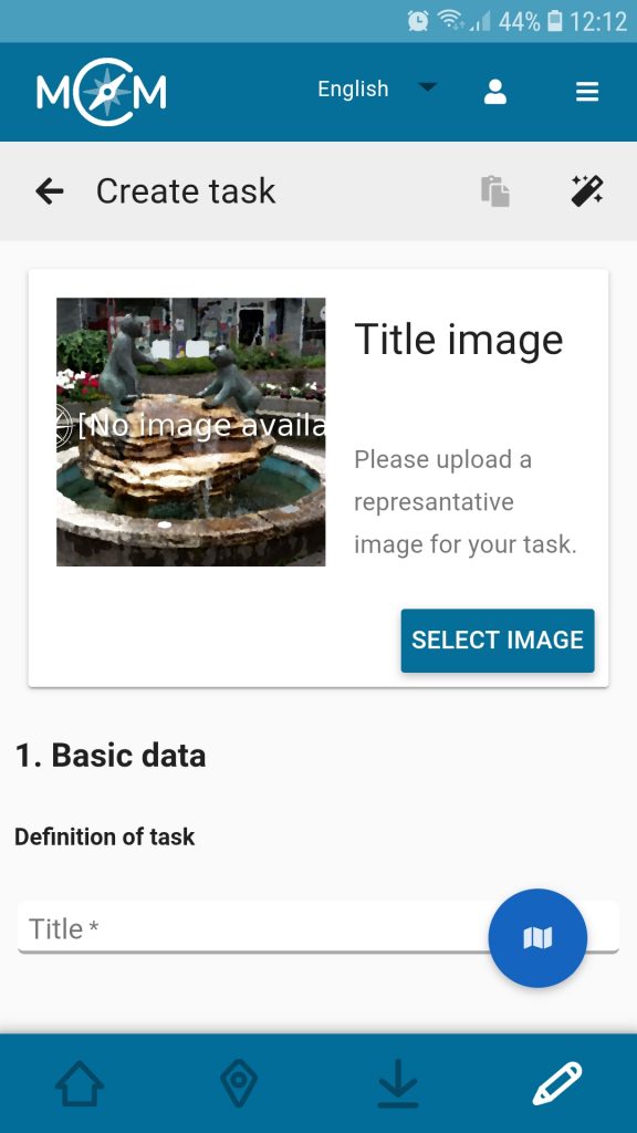
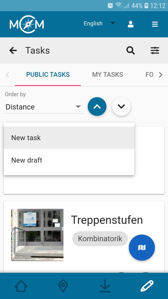
After launching our new web portal three weeks ago, we now celebrate our new MathCityMap App Update! In the following we present the new features:

New features:

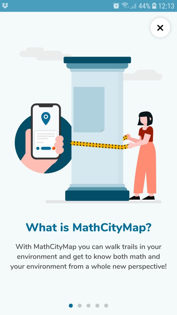
  • Our onboarding introduces the system with just a few clicks: With the help of our explanations the start into the world of MathCityMap is now even easier (photo 1).
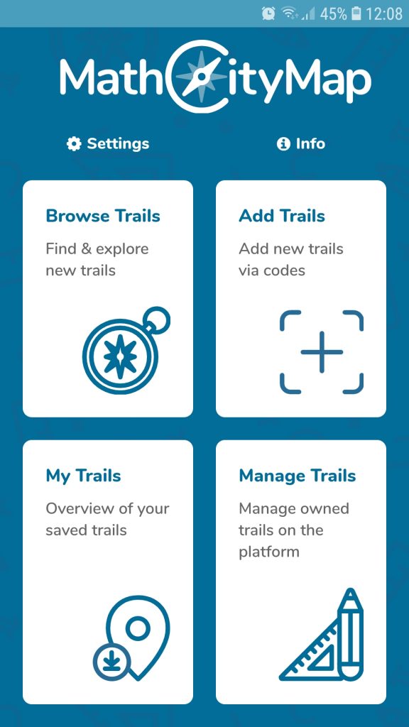
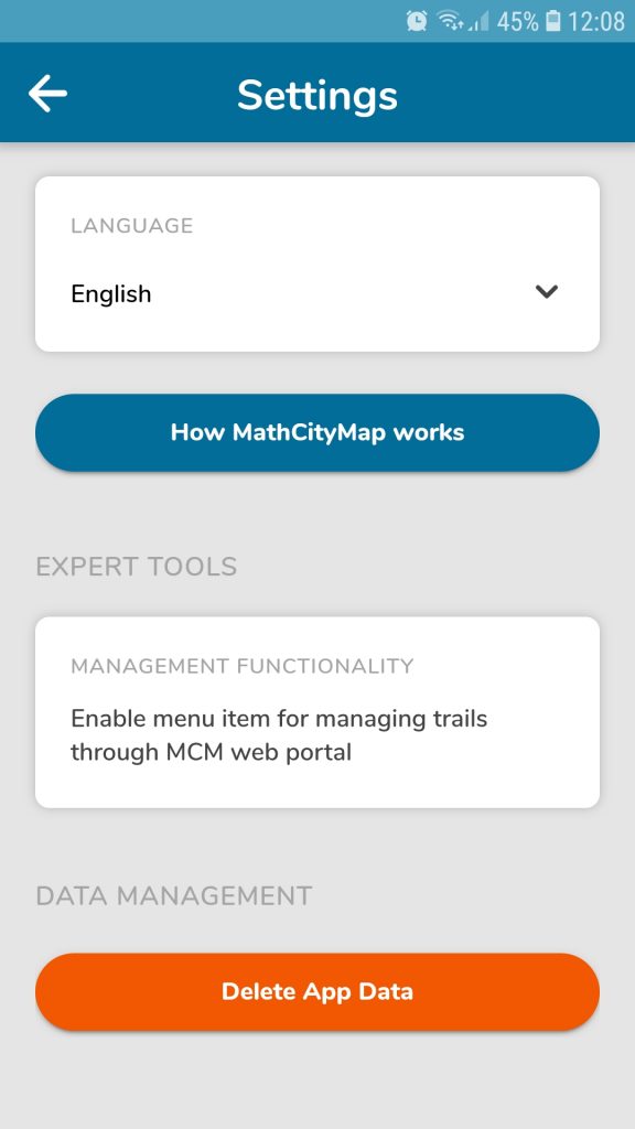
  • The author area is now available: With the MathCityMap app, registered users can create tasks while on the go via smartphone or tablet. Here it is possible to either create a complete task analogous to the web portal or to prepare a short draft which can be edited later at any time (photos 2 to 6).
  • The chat in the Digital Classroom was extended: Now it is also possible to send voice messages or pictures besides classic text messages. This allows teachers to support learners even better and more specifically via chat.

The new app version can be downloaded here for Android (Google Play Store) or here for Apple iOS. We hope you enjoy the new functions!

The MathCityMap idea:

With the MathCityMap app, students, teachers and individuals can rediscover their own environment from a mathematical perspective: Mathematical hiking trails, so-called maths trails, can be followed all over the world with the help of the MathCityMap App. After all, there are a multitude of mathematically interesting objects everywhere!

MathCityMap combines the editing of mathtrails with the possibilities of modern technologies such as GPS localization for orientation purposes, a support system through stepped hints and a feedback system. Mathtrails, once downloaded, can also be used in offline mode. The app is available in eleven different languages, including German, English, Spanish, Italian and French.

On our website you can become active yourself after a free registration and create your own tasks and mathtrails.

Webportal & App are developed by the working group MATIS 1 at the Institute for Didactics of Mathematics and Computer Science at the Goethe University Frankfurt am Main. Due to funding within the framework of the Erasmus+ projects MoMaTrE and MaSCE³ we can provide the app free of charge and free of advertising as well as conforming to data protection regulations.

MaSCE³ Meeting in the virtual space

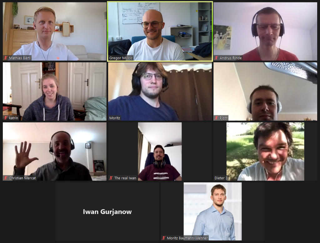
On the 18th and 19th of May we conducted our technical meeting of the MaSCE³ project. Unfortunately, due to the restrictions about personal contacts and international travelling, we had to more our meeting into the virtual space. Apart from the MathCityMap team from Goethe University Frankfurt, our project partners from the universities of Lyon (France), […]

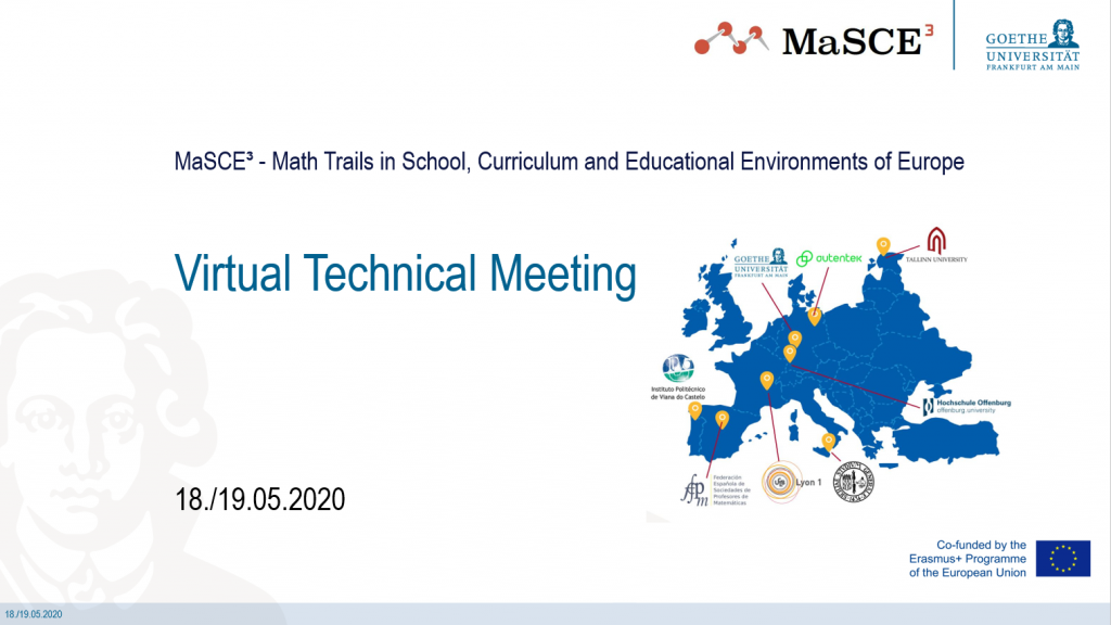
On the 18th and 19th of May we conducted our technical meeting of the MaSCE³ project. Unfortunately, due to the restrictions about personal contacts and international travelling, we had to more our meeting into the virtual space.

Apart from the MathCityMap team from Goethe University Frankfurt, our project partners from the universities of Lyon (France), Tallinn (Estonia) and the university of applied Sciences Offenburg (Baden-Wuerttemberg) also took part. Furthermore, we were actively supported by representatives of the the Berlin app developer from autentek.

 The development of the digital classroom as one of the intellectual outputs of the MaSCE³ project is nearly finished. The digital classroom provides the teachers with the possibility to create a time wise limited learning environment for their students. Apart from the e-portfolio, where all of the during the conduction of a math trail occurring events are stored and displayed, the chat functionality proofed to be a very useful tool for teachers. Especially during the corona crises and therefore the spatial separation of teachers and students, the digital classroom was often used for MathCityMap@home.

During the group works, we discussed the next steps of implementing also augmented elements into the MathCityMap system, as well as to define new task formats. By using augmented elemtns, it would be possible to pose completely new tasks and create problems for a variety of mathematical topics. For example, it could be possible for the teacher to attach virtual information to a real object. The students can discover and use that information by scanning the environment of the object with the camera of their smartphone inside the MathCityMap app. Furthermore, we also want to implement subtasks as a new format for tasks. Using subtasks, it would be possible to structure complex tasks and divide them into smaller, easier to solve problems. The students could then verify their solutions step by step.

The mandatory mathtrail had to be postponed. However, we hope to have soon the possibility to meet again face-to-face and will of course run again a mathtrail together!

We would like to thank all partners for the productive project meeting!

Task of the Week: The scooping ‘Dümpfelschöpfer’

The current task of the week is located in Lichtenfels, Germany. In this Franconian town the teacher Jörg Hartmann created the task “Der schöpfende Dümpfelschöpfer“ [engl. “The scooping ‘Dümpfelschöpfer’”] and answered several questions about it. How did you get in contact with the MathCityMap project? I first discovered the MathCityMap idea through a teacher training […]

The current task of the week is located in Lichtenfels, Germany. In this Franconian town the teacher Jörg Hartmann created the task “Der schöpfende Dümpfelschöpfer“ [engl. “The scooping ‘Dümpfelschöpfer’”] and answered several questions about it.

How did you get in contact with the MathCityMap project?

I first discovered the MathCityMap idea through a teacher training by Matthias Ludwig, head of the MCM team Frankfurt. During a project week at my school, the Meranier-Gymnasium in Lichtenfels, I offered a course on MCM trails.

Supported by six students of the nineth to the eleventh grade I created the math trail “Bergauf und Bergab, über Stock und Stein in Lichtenfels” [engl. “Uphill and downhill, over rough and smooth in Lichtenfels”], which contains the tasks “Der schöpfende Dümpfelschöpfer“. Subsequently I worked several times with different classes on the trail. A preparation of 20 minutes is suitable for this; the pupils then run the trail for two or three school lessons. The joy of the pupils is enormous, while the pupils experience mathematics in the open air – and the pupils learn an amazing amount.

Please describe your task. How can it be solved?

The famous sculpture in Lichtenfels, the so-called “Dümpfelschöpfer”, represent a man scooping water from an irregularly shaped pool. In the task I ask how often the man have to scope until the pool is empty. To solve the task, the students have to divide the problem into smaller subtasks, e.g. what the volume of the pool is or how units can be converted.

Which didactic goals do you want to promote?

I would like to encourage students which work on the math trail to perceive their environment from a mathematical perspective as well as to recognize the connection of school math and the real world. They might ask themselves which mathematical object has a similar shape to the bucket and how to convert a volume in m³ in litres.

Furthermore, I want students to do mental arithmetic and make rough estimation. By working on this task, they should realise how useful rough calculation is in everyday life.

Do you have any further commentary of MathCityMap?

I am enthusiastic about the idea of outdoor mathematics, and my students really enjoy to run a math trail. A lot of mathematical creativity is required to create a math trail. To be honest, at school the time to foster students’ mathematical creativity is limited – unfortunately I think the creation of a trail together with students is only possible during a project week.

Overall, the MathCityMap project is great! I really hope that some other users create trails around Lichtenfels, because I would definitely enjoy working on a “foreign” trail to get new ideas for math trail tasks.

The web portal 2.0 is finally there!

Like we announced last week, the new web portal 2.0 has been online since yesterday. It improves many existing features and looks stylish as well. The new design builds on the so-called Material Design by Google and allows for a flawless operation on all kinds of devices (computers, tablets and smartphones). An overview about the […]

General

Like we announced last week, the new web portal 2.0 has been online since yesterday. It improves many existing features and looks stylish as well. The new design builds on the so-called Material Design by Google and allows for a flawless operation on all kinds of devices (computers, tablets and smartphones).

An overview about the 11 most important changes:

  • General:
    • Two-column-fullscreen layout: In the layout of the new web portal, we no longer have a navigation menu on the left and thus have even more space for what really matters: Mathtrails! All important information is now consistently clustered in the left column while the map finds a home in the right column.
    • Mobile layout: Using a mobile device, the two columns are “on top of each other”. Pressing a button located on the bottom right of the screen, you can switch from one view to the other.
    • Map search: Using the search field on the map, it is possible to search for streets, cities or countries.
    • Favourites: Save your favourite trails and tasks and look them up quickly navigating to the favourites tab.
    • Sort and filter tasks and trails: In the list of trails and tasks it is possible to sort all items in an ascending or descending order according to different criteria. Additionally, it is now possible to filter items according to grade, date of creation or text. And, what is even better, the filter will also be applied to all items displayed on the map!
  • Mathtrails:
    • Restructuring of Mathtrails: The following sub-pages will simplify the creation and use of Mathtrails:
      • Edit Mathtrail: Change meta information (description, duration, place) and settings (enable / disable hints etc.) of a trail.
      • Edit tasks list: In this area, you can add tasks that are nearby your trail. Tasks that are already part of the trail can be rearranged or removed.
      • Digital classroom: The digital classroom has evolved into our favorite feature and as such, now gets its own separate area.
      • All sub-pages can be reached via the grey toolbar, once a trail is opened.
    • Creating a trail: The creation of a trail is now divided into two steps. In the first step, you create a “shell” for your trail. This shell contains meta information (name, place, description, image) and settings. New to this step is the need to define a center where your trail will roughly take place. To add tasks to your trail, simply open your trail and click on “Edit tasks list”
    • The trail carousel: When opening a task from inside a trail, it is now possible to “zap” through the tasks of this trail using the arrows below the grey toolbar.
  • Tasks:
    • Task drafts: A task draft is meant to quickly capture an idea for a task, for example while not at home. In contrast to the regular task form, you can fill in less fields when in draft mode (only image, position, title, description and tags). To be able to add your draft to a trail, it must be modified later.
    • Copy tasks: Sometimes you stumble across a nice task which you would like to also have near you, however, there is no wizard for this task yet. It is now possible to duplicate tasks. By default, this feature is activated for all tasks. However, if you do not want your tasks to be copied, you can disable this feature.
  • Digital Classroom :
    • Choose from more trails: You can now create a digital classroom for all public trails and not just your own.
    • Extend your classroom: While your digital classroom is active, it is possible to extend its duration by up to 30 minutes.
    • Push notifications: Activate push notifications to get notified in your browser as soon as a user joins the classroom or sends you a message.
    • Multimedia: In the chat in the digital classroom, it is now possible to receive images and audio files. The corresponding app update will come soon.


Further Changes:

  • General:
    • Main Menu: Forget the old toolbar. The entry point into the webportal is the new main menu. It is made up of tiles which will lead the user to the different areas of the webportal if clicked on. In the future, new content can be added easily to the main menu.
    • URL: The URL of all content has changed. Right now, it is not possible anymore to use the old URLs.
    • Languages: You can change the language of the webportal via the blue toolbar.
    • Profile preview: Every content now contains a profile preview (name, role, level) of its author.
    • Optimised image upload: All images are now uploaded via a separate dialog. In the case of cover photos, you need to slice your image so it has a quadratic shape. For all other images, it is elective to slice them. Automatically scaling the image before it gets uploaded, there should be less upload errors.
    • Share Content: In the grey toolbar, you will find a share icon which enables you to share content with others. Right now, it is possible to share content with a group. More sharing options will be added in the future.
    • State: Tasks and trails now have a section in the left column called „state“. In this section you will find information regarding the completeness of the form, the visibility and the review process.
    • My tasks / my trails: In these tabs you will find all content authored by you, independent from the currently visible map section.
    • New tab „For me“: This tab contains all content that was shared with you via a group
    • New tab „Favourites“: This tab contains all items which the user has marked as “favourite”.
    • Public content: In the tab „Public“, not all items will be loaded at once but only those in the currently visible map section and a little more. This helps to optimise performance.
  • Mathtrails:
    • Mathtrails that do not contain any tasks will be highlighted in the list
    • The fields „country“ and „city“ are filled in automatically when creating a trail using so-called reverse geocoding.
    • The list of the trails now contains – apart from the code, the place and the number of downloads – also the numbers of tasks in the trail as well as the distance to the current location
  • Tasks:
    • Task drafts are highlighted in the list of tasks. When they are opened, an additional notification informs you that this is only a draft.
    • Copied tasks contain a reference to the original task in the “state” section
    • Tasks that were created using the wizard contain a reference to the title of the wizard in the “state” section
    • You can open the task wizard when creating a new task by clicking on the magic wand symbol which is located in the grey toolbar
    • Tags are separated and confirmed pressing “Enter” and automatically get converted into so-called “chips”
  • Groups:
    • Groups now contain lists with all shared content. Via the list, it is possible to directly open the respective items
  • Reviews:
    • Before you are able to submit a task or trail into the review process, you will see a list containing all review guidelines and you must confirm that you are in possession of all image rights
    • The list of reviews now also contains information about how long an item has been in the review process
    • There are two new tabs “My history” and “History”. Here, it is possible for reviewers to see which and how many tasks or trails they have reviewed so far

Found a bug?

Just email info@mathcitymap.eu!


We are looking forward to your questions, suggestions and comments.

MCM meets Augmented Reality

Adi Cahyono, our MCM Educator of Indonesia, and Matthias Ludwig, head of the MCM Team Frankfurt, present how an augmented reality mobile math trails program can provide opportunities for students to engage in meaningful mathematical modelling activities. Therefore, an explorative study was conducted involving two mathematics teachers and 30 eight grades in Semarang, Indonesia. The […]

Adi Cahyono, our MCM Educator of Indonesia, and Matthias Ludwig, head of the MCM Team Frankfurt, present how an augmented reality mobile math trails program can provide opportunities for students to engage in meaningful mathematical modelling activities. Therefore, an explorative study was conducted involving two mathematics teachers and 30 eight grades in Semarang, Indonesia. The students worked on several math trail tasks using an Augmented Reality Mobile Math Trails App, which was specifically created for this study.

The findings indicate that a mobile app with augmented reality features is helpful for students as a tool that bridges the gap between real-world situations and mathematical concepts in problem-solving following the mathematical modelling cycle.

The article „Learning mathematical Modelling with Augmented Reality Mobile Math Trails Program: How can it work?” was published in the Journal on Mathematics Education. The full text is available online here. The cover pictures are taken from this article.