MCM Guest Lecture in Indonesia

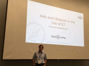
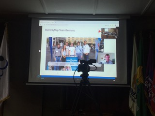
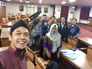
On April 22, there was a small premiere at the University of Semarang, Indonesia. For the first time a lecture took place completely over the Internet and was transferred into several rooms. By invitation of Adi Nur Cahyono (MCM Educator for Indonesia), Joerg Zender gave a lecture on outdoor education in the field of mathematics […]

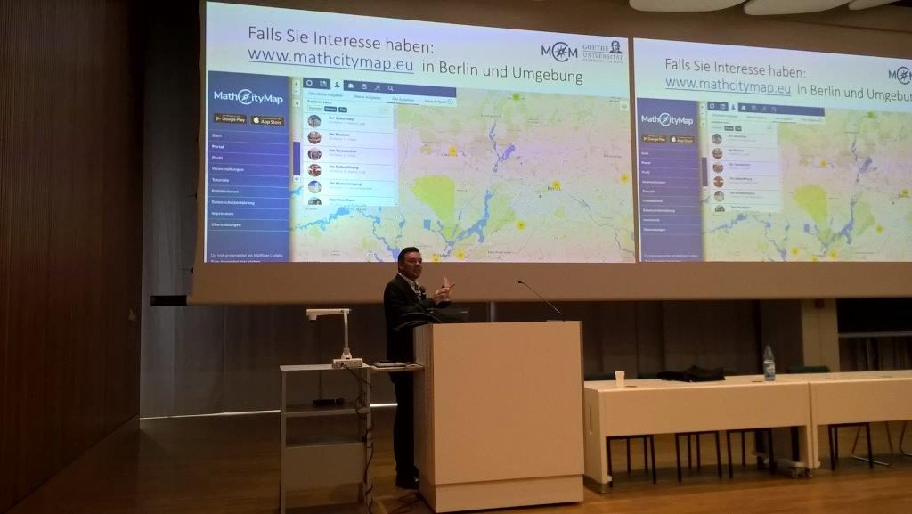
On April 22, there was a small premiere at the University of Semarang, Indonesia. For the first time a lecture took place completely over the Internet and was transferred into several rooms. By invitation of Adi Nur Cahyono (MCM Educator for Indonesia), Joerg Zender gave a lecture on outdoor education in the field of mathematics didactics, introducing MathCityMap and its research findings. In general, the challenges of quantitative research have been addressed and, in particular, the open questions associated with research work have been discussed. After the approximately 90-minute presentation there was still room for questions. The participants were particularly interested in the possibilities to use MathCityMap in class. Most of the questions involved the process of organizing and organizing a mathtrail with MCM, as well as possible topics and response formats that could be used to translate mathematical questions.


Task of the Week: A cover for the sandbox

Today, MCM talks with Philipp Larmann about the task of the week in Frankfurt/Main, Germany. He studied mathematics education for secondary and grammar schools at Goethe University and was a participant in the MoMaTrE Intensive Study Program 2019. The task was awarded the Most Mathematical Task Award in the category Lower Secondary. The task was […]

Today, MCM talks with Philipp Larmann about the task of the week in Frankfurt/Main, Germany. He studied mathematics education for secondary and grammar schools at Goethe University and was a participant in the MoMaTrE Intensive Study Program 2019. The task was awarded the Most Mathematical Task Award in the category Lower Secondary. The task was developed in collaboration with Kristína Galová (SK), Silvia Haringová (SK), Maria Joana Monteiro (P) and Clément Guérin (F).

What is the task about?

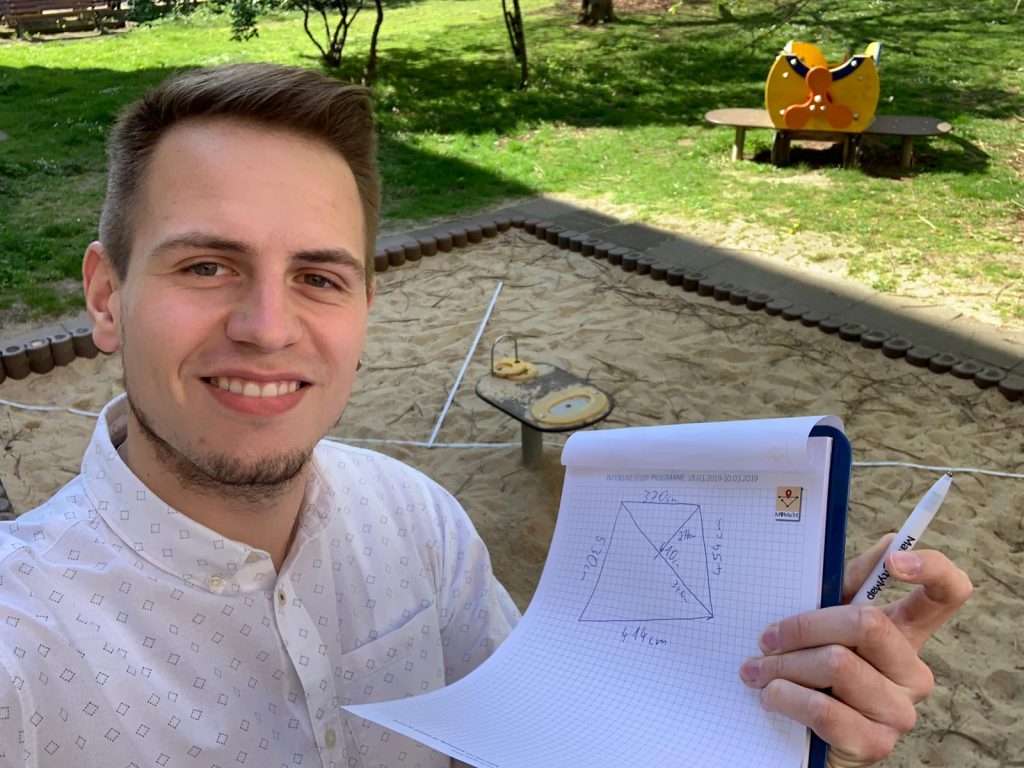
The task is about a sandbox and the area of its surface, because you want to cover it during the winter. The special thing about the sandbox is that it has the shape of a general rectangle, so it has no right angles and all sides have different lengths. The students who work on this task therefore have to think for themselves how to best divide the surface of the sandbox into well-known geometrical forms, the area of which can then be calculated.

The sandbox needs a cover. Please calculate the area of the sandbox. Give your solution in m².

For what purpose was this task created?

That a right triangle can also be considered as half of a rectangle should be experienced by the students working on the task and it is essential to solve this task at this grade level.

What do you like about MathCityMap?

MathCityMap is a perfect enrichment for math lessons. The learning and working on real objects, the possibility to use elements of gamification, and the versatility of possible tasks are highly motivating for the students. With the use of MathCityMap interesting introductions into new topics can be created as well as well-known contents can be further deepened and practiced.

Thank you for your Engagement for MathCityMap!


Maintance notice for Thursday, 21st February

We are planning to deliver a new update this Thursday morning. Since data structure changes are involved, technical malfunctions cannot be excluded during this day. If you have disabled automatic updates for your apps, please check manually for available updates on this day on the app stores (App Store for iOS, Google Play for Android). […]

We are planning to deliver a new update this Thursday morning. Since data structure changes are involved, technical malfunctions cannot be excluded during this day.

If you have disabled automatic updates for your apps, please check manually for available updates on this day on the app stores (App Store for iOS, Google Play for Android). We advice against using an outdated version of the MCM app, since technical malfunctions could occur.

Jörg Kleinsteuber becomes first “MCM-Educator” in Germany

MathCityMap certifies active members within the MCM community. The most comprehensive MCM certificate is the “MCM Educator”. In order to be certified as an “MCM-Educator”, it is necessary to have created tasks and trails, as well as a whole series of task reviews according to the MCM criteria. In addition, the successful participation within an […]

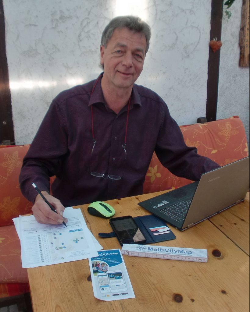
MathCityMap certifies active members within the MCM community. The most comprehensive MCM certificate is the “MCM Educator”. In order to be certified as an “MCM-Educator”, it is necessary to have created tasks and trails, as well as a whole series of task reviews according to the MCM criteria. In addition, the successful participation within an official MCM training is necessary. As an MCM Educator, you have the right and the obligation to provide official training in the name of MathCityMap, and you have access to the materials of MCM.


On the occasion of the certification as “MCM Educator” MathCityMap interviewed Jörg Kleinsteuber.


Hello Jörg, could you briefly tell us something about you and your experience with digital media in school?

I am a teacher of math, physics and computer science at the Elisabeth-Gymnasium in Eisenach. I am happy me and my students various digital aids in my lessons, e.g. we work on our school with: bettermarks.de, lo-net², phyphox, Geocaching, APP clevery (Ma and En), TI-nspire CAS, TI Innovator & Rover, padlet.com, Lego mindstorms, KAHOOT, scratch, calliope mini, learning snacks, among others.


How did you hear about MCM?

I discovered MathCityMap in March 2018 during a workshop at the MNU conference in Erfurt.


What convinced you about the system? What do you think is special?

I was fascinated by the combination of classical mathematics with digital support. Mathematics does not have to be complicated calculations and effortful applications. Small tasks with practical relevance, where learners themselves have to become ACTIVE by measuring, modeling, estimating, discussing in small groups offer plenty of potential for student activities.

The possibility to use the smartphone as a support is of course a matter for the learner but also motivating. At the same time this reduces my effort in the care, because the APP provides feedback in the form of clues, model solutions and also offers gamification (points). A great mix! In the follow-up in the classroom very stimulating discussions appear.


What do you intend to do as an MCM Educator? What are your plans for MCM?

As an MCM Educator, I would like to introduce other teachers to this opportunity of “change” for their lessons. At the SINUS Conference in Apolda (Thuringia) at the end of October 2018 , for example, interested teachers in a workshop test these possibilities themselves.

So far, we have already created a pool of about 30 tasks around our school in Eisenach. This may take some work, but first of all, everyone can now use these tasks and secondly, there are already some tasks created by students. When students themselves develop such tasks, the intensity of their engagement with the content, as well as their digital implementation is much higher. For example, Grade 10/11 students prepared for the Open House, which was then enthusiastically resolved by the visitors.

Also, in Eisenach there are already 2 public trails, which can be used by all those interested.

Gladly, I also examine new tasks of other users. As a result, I often get suggestions for great types of tasks and at the same time help to ensure that even more ready-made tasks and routes are available for public. Although MCM is mainly relevant to the subject of mathematics, during the review I have already seen tasks from other departments – there is no limit to the creativity of the users.


Thanks for the Interview and your encouraged effort for MCM!

MCM Educator Jörg Kleinsteuber, Teacher at Elisabeth-Gymnasium in Eisenach

“Outdoor Mathematics” at MNU in Berlin

On the 11th and 12th September 2018, the annual MNU conference Berlin/Brandenburg took place at the Freie Universität Berlin. MathCityMap was represented as well. In the main opening lecutre, Prof. Dr. Matthias Ludwig presented possibilites to include mathematics in an out-of-school-environment. Next to classical methods, the focus was furhter on GPS-based technologies and the use […]

On the 11th and 12th September 2018, the annual MNU conference Berlin/Brandenburg took place at the Freie Universität Berlin. MathCityMap was represented as well.

In the main opening lecutre, Prof. Dr. Matthias Ludwig presented possibilites to include mathematics in an out-of-school-environment. Next to classical methods, the focus was furhter on GPS-based technologies and the use of mobile devices. About 200 participants gotto now outdoor mathematics as a chance to transfer their normal classroom teaching.

A strong interest was on the workshop “MathCityMap – live and interactive” hold by Prof. Dr. Matthias Ludwig und Martin Lipinski.


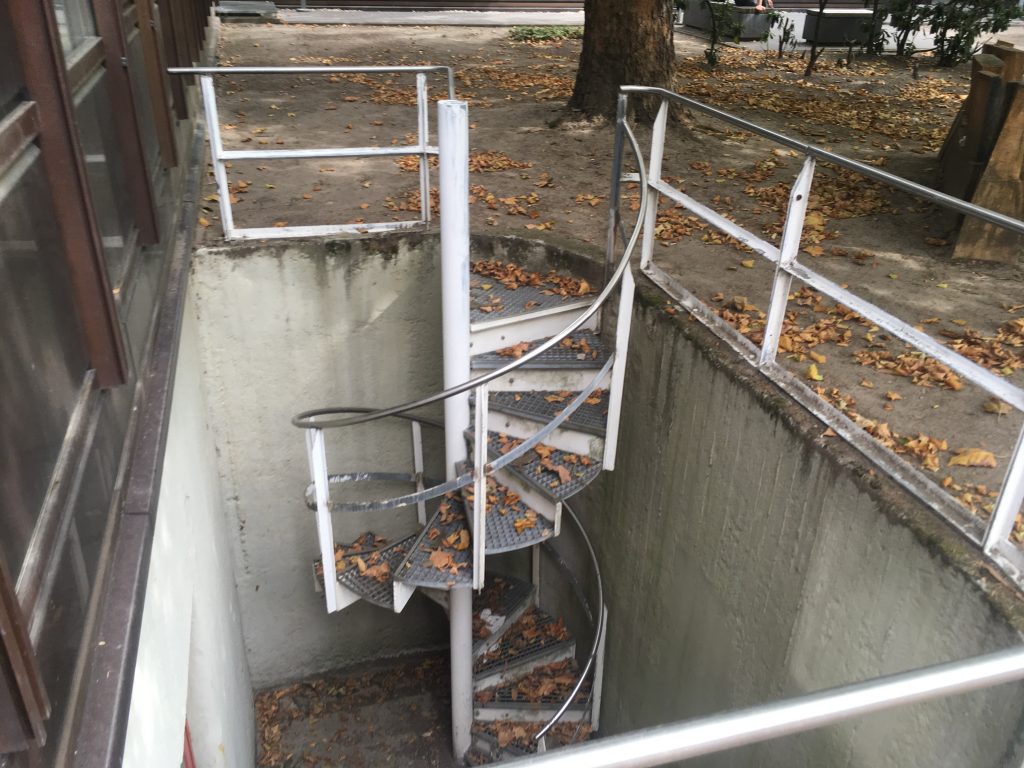
With help of the MathCityMap-App, measuring instruments and great motivation among the participants, the tasks around the campus were solved. As an example, we want to show the slope of the spiral staircase.


Finally, the participants created own tasks in the webportal (www.mathcitymap.eu), which were used to create an own small math trail.

4000th MathCityMap Task in the Portal

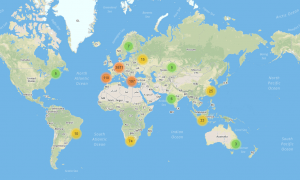
With this great summer weather, it is no wonder that the math trailers move outside. We are very pleased that this week the 4000 task border was reached in the portal. Outdoor mathematics with MathCityMap around the globe is achieved with help of currently about 1500 users. Together, over 600 routes were created in 17 […]

With this great summer weather, it is no wonder that the math trailers move outside. We are very pleased that this week the 4000 task border was reached in the portal.

Outdoor mathematics with MathCityMap around the globe is achieved with help of currently about 1500 users. Together, over 600 routes were created in 17 different countries. Significant actors are next to our international cooperation partners of MoMaTrE and the MOOC of the University of Turin of course the many motivated task creators who use MathCityMap at their school, university or in their free time. Thanks a lot!

As a result, we can observe a great development of the project and are already making future plans!

Math Trail in Gemünden

MathCityMap was mentioned in the Mainpost Gemünden. Read the English version below. With ruler and measuring tape, two classes of the Theodosius Florentini School ran a math trail in Gemünden’s old town under the guidance of the project seminar “Math Trail”.  This was reported by Anna Hellinger and Anna-Lena Haas (both Q11) in a press […]

General

MathCityMap was mentioned in the Mainpost Gemünden. Read the English version below.

With ruler and measuring tape, two classes of the Theodosius Florentini School ran a math trail in Gemünden’s old town under the guidance of the project seminar “Math Trail”.  This was reported by Anna Hellinger and Anna-Lena Haas (both Q11) in a press release.

Using the MathCityMap app of the Goethe University in Frankfurt, the 11th-grade students, under the direction of Henrike Hohmann, designed creative tasks that together resulted in two varied math trails for the 7th and 10th grade. With increasing sunshine, the mood of the students also increased and they got to know a new, practical side of the otherwise rather theoretical subject of mathematics. This was also reflected in the feedback, because contrary to the expectations of many students, mathematics can be quite enjoyable, the press release states.

After a long planning and after the “Math Day”, the first big milestone goal of the project seminar has been reached. In the near future, the trails for the 7th and 10th grade Gymnasium will be published so that they are freely accessible to the general public via the MathCityMap. In addition, a “family trail” is planned whereby the required material will be provided in the Tourist Info in Gemünden. Thereby, the students of the project seminar want to support not only the mathematics, but also the sightseeings of the “Three Rivers City”.

MathCityMap is “math doer” of the month!

We are very pleased that MathCityMap was honored by the German Mathematical Association (Deutsche Mathematiker Vereinigung DMV) as “Math doer” of the month June. In doing so, special commitment and creativity in the use and handling of mathematics are recognized. For our entire team, this award is a great honor, because “Math oder” honors exactly […]

General

We are very pleased that MathCityMap was honored by the German Mathematical Association (Deutsche Mathematiker Vereinigung DMV) as “Math doer” of the month June. In doing so, special commitment and creativity in the use and handling of mathematics are recognized. For our entire team, this award is a great honor, because “Math oder” honors exactly what marks MathCityMap – doing mathematics in the environment.

On the DMV side Matthias Ludwig gives an insight into the project development, as well as ideas behind MathCityMap (English version below). We hope you enjoy reading and thank you for the interview!

Interview – English version

“Math Doer” of the month June 2018 are the people behind MathCityMap. The idea of ​​their app: Students walk around the area and solve measuring and arithmetic tasks at several stations that are provided by the app. There is almost nothing that cannot be used as a trail object. Sometimes they measure tree trunks to calculate their age, or how fast the steps of an escalator run. The students immediately see on the screen of their smartphone whether they are right. You also see that in many things there is a lot of mathematics and it is basically very concrete. Thousands of users, mostly teachers, have created their own nature trails and shared them on mathcitymap.eu. Here, project manager Matthias Ludwig gives a look behind the scenes and reveals how the MathCityMap team wants to force its competitor Pokémon Go.

Mr. Ludwig, how did you come up with the idea for MathCityMap?

As I was still teaching, I liked to lead my students away from the textbooks, out of the classroom, into the real world. With measuring and writing equipment, we walked through Würzburg’s vineyards and measured grapevines, the slope, a pond in the park or other objects in the city. A kind of outdoor station learning, whereby the students playfully gained a look for the mathematics in the things and always experienced a little adventure. The idea of ​​the mathematical trails came up in England in the 1980s. The usual tasks at the time were various: determine water speed, count combinations, and so on. Too various for a lesson. With MathCityMap we adapt trails in terms of content and time to lessons and into the twenty-first century. The mobile technologies offer new possibilities: better distribution and exchange, assistance and direct feedback on solutions. It forms a large community. Everyone can basically join in, even get creative and design and share their own trails. In addition, we can also explore the learning effects, because we link recorded data with students’ handwritten notes.

Why do you want that?

One question was how to make smartphones useful in class. So far, the literature includes more qualitative assessment of the trails à la it is great, makes fun. We conduct evaluation studies to capture the didactic benefit. For example, we found that gamification is beneficial. The students are more motivated when competing in groups for points. Otherwise, you tend to guess results. The bottom line is that it is a win-win-win situation: students are more motivated and on average learn better than the control group in the classroom, teachers have material and variety, and we learn how good the whole thing is.

How does a place become mathematically interesting?

It always depends on the creativity of the user. It may be the most trivial things that are usually ignored: the pavement in the pedestrian zone, which symmetry does it have? How many paving stones are on this place? The bus stop on our street, how likely will the bus arrive in the next five minutes? The tree in the schoolyard, how old is it? This is proportional to the diameter in a certain age range. Or the statue in the fountain, which mathematical shoe size does it have? Of course you can exaggerate this with figures of the environment. Therefore, and as a kind of interdisciplinary link, we use “sidefacts” in the app, which tell a little about the history of the places.

The tasks often focus on geometry and surveying …

Yes, geometry is strongly represented. Once because it fits the school content. Then lengths, areas, gradients are practically measured and are also in the literal sense obvious, more than a probability. These schemes also spread more, because they work almost everywhere and we provide technical support when creating: With the task wizard or generic tasks, it is possible to pick up a schema and create it for my city in just a few clicks. But measuring is not everything. On the way to solution,  one also has to apply equations correctly, solve for variables and calculate with units. If the volume of a stone is required, one has to  model it mathematically, find the appropriate elementary geometric body. But also questions of analysis, combinatorics, and soon also of analytic geometry occur.

Who is MathCityMap aimed at?

Recreational mathrailers are more the exception. As a mathematics didactics, we mainly take care of the school area and lessons. We know that teachers are under pressure and have little time for additional preparation. We try to make it as easy as possible for them.

Do you check the trails created by users?

You can create private trails that only your students can access via code. There, the quality is simply ensured by your competence and the required input fields – solution hints, solution, photo, coordinates, etc. If you want to share the trail with the whole world, our team checks before the publication  whether everything is consistent and technically perfect. This is going well, also thanks to our competent project partners worldwide, who check trails in other countries. And the network is growing.

Sounds like a viral success.

Well, still we are not a serious competitor for Pokémon Go, an app with the same gaming concept. But for people who want to get away from that stuff, we will set up distribution points for our “Mathadon”. Joking aside, there are over three thousand tasks and more than five hundred trails in eleven languages. We plan MathCityMap institutes, where further education for teachers, trail authors etc. should take place. The international exchange is enormously inspiring. I always thought I had a lot of imagination, but I always meet people who top that easily. They would create a good trail in the desert, too. That’s great! At the end of the funding period through the EU, 2020, we are making a big congress. And hope for renewal.

Thank you very much for the interview, Mr. Ludwig, and all the best for your team and MathCityMap!
 

Made in Taiwan

MathCityMap was part of the East Asian Conference On Mathematics Education 8 (EARCOME8) which took place in Taipeh, Taiwan. On Wednesday afternoon, about 30 participants were part of a “Special Sharing Group”, in which interested mathematics educators could make first experiences with MCM. After a typical Asian restraint in the beginning and the first cooperative […]

EventsGeneral

MathCityMap was part of the East Asian Conference On Mathematics Education 8 (EARCOME8) which took place in Taipeh, Taiwan.

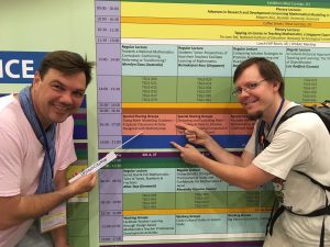
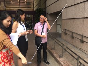
On Wednesday afternoon, about 30 participants were part of a “Special Sharing Group”, in which interested mathematics educators could make first experiences with MCM. After a typical Asian restraint in the beginning and the first cooperative solved tasks, the participants were fascinated and measured, counted and calculated diligently.

You can find the trail here.

As part of the conference, there were two further presentations given by Hanna Gärtner and Joerg Zender from Goethe University, both very successful. Joerg Zender presented the findings on the two annual surveys among MCM users.

BILD rejoices in MathCityMap

Also in the regional edition of BILD Zeitung Stuttgart, MathCityMap and the opening of the MATHE.ENTDECKER trails around Stuttgart’s stock exchange were mentioned. In the category “What we rejoice in” it said: This makes learning fun. From now on, four new “Mathe.Entdecker Trails” exist around Stuttgart’s stock exchange. In the app MathCityMap, objects and places […]

EventsGeneral

Also in the regional edition of BILD Zeitung Stuttgart, MathCityMap and the opening of the MATHE.ENTDECKER trails around Stuttgart’s stock exchange were mentioned. In the category “What we rejoice in” it said:

This makes learning fun. From now on, four new “Mathe.Entdecker Trails” exist around Stuttgart’s stock exchange. In the app MathCityMap, objects and places become vivid math tasks.

We can only agree with this statement!