Trail of the month: Tracing circles and bodies in Hanover

  November’s Trail of the Month comes from the capital of the German state of Lower Saxony. The trainee teacher Franziska Hormann created the trail “Circles and bodies on the trail in Hanover”, which can be accessed in the MCM app under the code 386349. It is available in the web portal here. On this mathtrail […]

Trail of the Month


November’s Trail of the Month comes from the capital of the German state of Lower Saxony. The trainee teacher Franziska Hormann created the trail “Circles and bodies on the trail in Hanover”, which can be accessed in the MCM app under the code 386349. It is available in the web portal here.

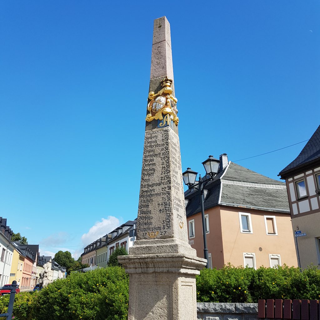
On this mathtrail you will find a total of nine tasks implemented on the buildings and artistic sculptures of Hanover’s city center.


How did you come across the MathCityMap project?

As a former student at Goethe University, I was already able to get to know MCM during my studies in the module Upper School Didactics, where I also designed my first tasks. In Frankfurt, the app is widely used, so I was surprised that in Hanover, where I am currently completing my traineeship, there are only a few MCM trails and the project was hardly known among teachers or at our study seminar. However, my interest in sharing and spreading it in my home region was correspondingly great, especially since the beautiful old town of Hanover offers ample opportunities to apply mathematics…


Please describe your Mathtrail.

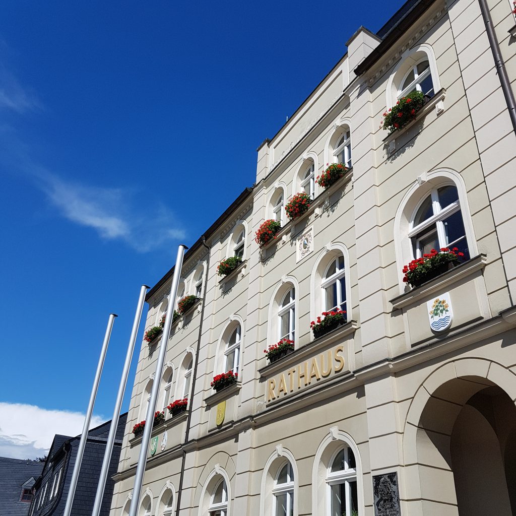
The Mathtrail is specially designed for the topic of circle and solid calculation, which is taught in the 10th grade in Lower Saxony. On a circular route through the old town past well-known places such as the New Town Hall, the Market Hall and Church or the Ballhof, students can apply their knowledge of the circumference and area of circles, surface area and volume of cylinders and spheres and test it on authentic problems.
The trail is particularly suitable at the end of the unit, when all the formulas are already known and the constructed tasks from the textbook have had their day. I myself tried it out as part of a project day with a 10th grade class, and since the topic is usually taught at the end of the school year in Lower Saxony, such a project day before the vacations is particularly worthwhile, on the one hand to do mathematics in the world around us at an extracurricular learning site, and on the other hand to offer an alternative to the annual movie watching in the last few weeks.


How do you use MCM and why?

Since I am still at the beginning of my professional life, I have so far only used MCM for this specific trail in the said 10th grade. In my opinion, MCM is especially (but not only) suitable for geometry topics, in which I will gladly use it again in other grades. On the one hand, as a teacher myself, it is a pleasure to design the tasks and to rediscover old familiar things with a different view. In addition, the possibility of publishing the paths means that other teachers can also benefit from the efforts. On the other hand, I feel it is important to experience mathematics in real-life contexts that are as authentic as possible, to become active myself and to have to puzzle. MCM can make all this possible with well-set tasks, where the groups have to coordinate and find heuristic strategies for calculating solutions together, which also promotes their ability to work in a team.
Last but not least, out-of-school learning venues are rare in the subject of mathematics. MCM makes it possible, regardless of the proximity to facilities such as the Mathematikum in Giessen, etc., to design an extracurricular learning venue that can be adapted to one’s own lessons with manageable effort and thus make mathematics experienceable in a different way.


Describe your favorite task of the trail. How can it be solved?

I believe that all tasks have their charm and sometimes require less and sometimes more modeling competence. I like the starting task of the trail with the Hase fountain, for example, because in the beautiful brick backdrop between the Old Town Hall and the Market Church, you first have to perceive this historic structure simplified as a cylinder and then come to the determination of the water volume via various paths, the circumference of the basin or the partly estimated radius, whereby the correct unit must not be neglected at the end. In this task you also have to have the courage to hold the folding rule properly in the water for once.
I like tasks where the solution is not immediately obvious and where you have to fiddle a bit without increasing frustration. That’s why the solution interval should not be too small, which I learned myself during the test.

Generic Tasks: Combinatorics

The so-called Generic Tasks offer a significant simplification when creating MathCityMap tasks. Generic tasks are tasks for objects that can be found, in a slightly modified form, in any place in the world. They are therefore tasks that can be implemented almost anywhere. Within the MoMaTrE project, several Generic Tasks, covering different topics, have been […]

The so-called Generic Tasks offer a significant simplification when creating MathCityMap tasks. Generic tasks are tasks for objects that can be found, in a slightly modified form, in any place in the world. They are therefore tasks that can be implemented almost anywhere. Within the MoMaTrE project, several Generic Tasks, covering different topics, have been developed and implemented in the MCM web portal. You create a Generic Task by activating the so-called Task Wizard via the magic wand icon in the “Create task” section. Here you select the desired topic and object and enter only the data collected from your own object. The wizard then automatically creates a completely filled out task form with a ready-made sample solution, a suitable task text and appropriate hints. After inserting a task image, the task is thus ready for publication and can be used within a very short time.


In this and the following articles, we would like to introduce the various topics and objects for which Generic Tasks are currently available in the Task Wizard. First, we will take a look at the topic of combinatorics.

An object that can be found almost everywhere are stairs. Of course, a staircase can be used to design a wide variety of tasks. However, one combinatorial task that can be applied to any staircase is the following generic task:

“How many possibilities exist to go upstairs if one can take one or two steps within each move? The step sequences can be combined.”

There are several approaches to solving this task:
One approach is to write down the possibilities systematically.

Another approach to solving the problem is to use the Fibonacci series:

(1) 1 2 3 5 8 13 21 34 55 89 etc.

When creating the task, you only have to specify how many steps the staircase consists of on which you want to create this task. Everything else will be filled in automatically by the task wizard.


Another object for which a Generic Task from the combinatorics section was created and which can be found quickly is a bicycle stand. Here, the following task is generated by entering the number of existing bicycle racks and a quantity x of bicycles that you specify.

“x bikes should be locked at the stand. Each bike can be locked at the left or right. How many possibilities exist to lock the x bikes at the stand? It does not matter whether the bikes are locked “forwards” or “backwards”. You can assume that the stand is completely empty.”

Again, suitable sample solutions and hints are created by the wizard without any action on your part.

In the next article on Generic Tasks we will show you which possibilities for tasks regarding the topic “Slope” are already available in the task wizard of MathCityMap. Until then, we wish you a lot of fun and saved time when creating your own tasks!


MCM Seminar at the Deutsches Eck

  In the summer semester of 2021, the first MCM seminar was held at the University of Koblenz-Landau, Koblenz Campus. Despite the difficult conditions caused by the pandemic, the students were able to work in small groups in compliance with the applicable rules, first learning the theoretical basics at home and then moving out into […]


In the summer semester of 2021, the first MCM seminar was held at the University of Koblenz-Landau, Koblenz Campus. Despite the difficult conditions caused by the pandemic, the students were able to work in small groups in compliance with the applicable rules, first learning the theoretical basics at home and then moving out into the field. In the first step, they put themselves in the role of students and explored Simone Jablonski’s Koblenz Trail in groups. After that, they went to work themselves. The focus of the seminar was on the primary level and accordingly many trails suitable for primary schools were created throughout Rhineland-Palatinate.

Unfortunately, the flood disaster of July also left its mark on the MCM Seminar. The floods of Ahrweiler completely destroyed a mathtrail in the Ahrweiler valley. Thankfully, the student who created it remained unharmed.

The seminar was very well attended with two times 45 students and the students visibly enjoyed the unusual way of doing mathematics. The seminar is part of the dissemination of the EU funded MoMaTrE project.

In the course of the seminar, various video contributions were made by the students. In each of the videos, they present an MCM task from the trail they designed, and they also go into more detail about the didactic background of their task. We would like to share one of these videos with you. Have fun watching it!


Mathe.Entdecker: Experiencing Zwönitz mathematically.

In the past months of July and August, the MathCityMap team from Frankfurt visited the German city of Zwönitz. Here our team created a total of 17 new trails, which were now officially opened and published! With the support of Stiftung Rechnen, the town of Zwönitz and its Smart City Zwönitz project, we have created […]

In the past months of July and August, the MathCityMap team from Frankfurt visited the German city of Zwönitz. Here our team created a total of 17 new trails, which were now officially opened and published!

With the support of Stiftung Rechnen, the town of Zwönitz and its Smart City Zwönitz project, we have created Math.Discoverer trails (Mathe.Entdecker-Pfade) for classes and families in and around the town, which is located in the middle of the Ore Mountains. On the website of Stiftung Rechnen and in a video report by erzTV, you can find more background information about the Math.Discoverer paths and the Smart City Zwönitz project.

The Mathtrails lead through different parts of the Smart City Zwönitz: the city center, past the train station and through the Austelpark, along the Sendigmühle and the Knochenstampfe. The grand opening with school classes trying out the Mathtrails took place on 12.10.2021 in the presence of the mayor of the city of Zwönitz. You can find a flyer with descriptions of the trails here.

Below we list all our created trails in Zwönitz. We wish you a lot of fun and success trying them out!


Title incl. Link

Code

Duration | Distance

Eröffnungstrail Klasse 5

[Opening Trail – Grade 5]

156358

2h 20 min | 700 m

Eröffnung Klasse 6

[Opening Trail – Grade 6]
476359

1h 40 min | 800 m

Innenstadt Familie

[City Center for families]

696049

2h 50 min | 1.300 m

Innenstadt Klasse 3/4

[City Center – Grade 3/4]

496048

2h 40 min | 1.300 m

Innenstadt Klasse 5-7

[City Center – Grade 5-7]

046050

2h 30 min | 1.400 m

Innenstadt Klasse 8-10

[City Center – Grade 8-10]

056052

2h 30 min | 1.000 m

Zwönitz für Familien 3/4

[Zwönitz for families – Grades 3/4]

255938

1h 40 min | 1.600 m

Zwönitz für Familien 5/6/7

[Zwönitz for families – Grades 5/6/7]

085939

2h 20 min | 1.600 m

Austelpark Familie

[Austelpark for families]

466044

2h 00 min | 900 m

Austelpark Klasse 3/4

[Austelpark – Grades 3/4]

292265

1h 20 min | 700 m

Austelpark 5/6/7

[Austelpark – Grades 5/6/7]

026046

2h 10 min | 800 m

Austelpark 9/10

[Austelpark – Grades 9/10]

296047

2h 00 min | 900 m

Ziegenberg Familie

[Ziegenberg for families]

786039

2h 00 min | 1.300 m

Ziegenberg Klasse 7/8

[Ziegenberg – Grades 7/8]

896038

2h 00 min | 1.400 m

Ziegenberg Klasse 9/10

[Ziegenberg – Grades 9/10]

576040

2h 00 min | 1.300 m

Knochenstampfe Familie

[Knochenstampfe for families]

136043

1h 50 min | 200 m

Knochenstampfe Klasse 5/6

[Knochenstampfe – Grades 5/6]

036042

1h 50 min | 200 m

MCM goes Canada

From September 9 to October 8, we were able to collaborate with Simon Fraser University in Vancouver, Canada on a new project on outdoor mathematics and MathCityMap. Visiting the research group of Prof. Dr. Nathalie Sinclair, we dedicated ourselves to research on embodiment and gestures while walking a mathtrail: When students work on real objects, […]

From September 9 to October 8, we were able to collaborate with Simon Fraser University in Vancouver, Canada on a new project on outdoor mathematics and MathCityMap. Visiting the research group of Prof. Dr. Nathalie Sinclair, we dedicated ourselves to research on embodiment and gestures while walking a mathtrail: When students work on real objects, it seems natural that they interact with the object and describe mathematical concepts through gestures.


We started by looking at the SFU campus, and we didn’t have to search long for suitable tasks! Not only the pyramid seemed to be made for MCM! In the course of an advanced training with 20 teachers, the tasks could then be tested directly. Afterwards, five groups were filmed solving the tasks. In the evaluation, we will focus on when and with which function different gestures were used. We will submit these results at the next PME conference (2022 in Valencia).

Of course, we did not miss the opportunity to create some trails in downtown Vancouver – both the Waterfront Station and the Stanley Park were ideal addresses for our first “Canadian Math Trails”.


The study and the accompanying research stay are funded by the DAAD and the BMBF within the framework of the Project-related Exchange of Persons (PPP) Canada.

Behind the Scenes Part III: Task Review

  The third article in our “Behind the Scenes” category is intended to conclude the first thematic block, the process of publishing and reviewing tasks. The two previous articles dealt with the steps up to the request for publication on the side of the users and the criteria according to which we, the MCM team, […]

Behind the Scenes


The third article in our “Behind the Scenes” category is intended to conclude the first thematic block, the process of publishing and reviewing tasks. The two previous articles dealt with the steps up to the request for publication on the side of the users and the criteria according to which we, the MCM team, decide whether a task is to be published or not yet. In the following, we would like to illustrate the steps of a review by means of a specific example.


In the task “Weißer Reiter” (“White Rider”) you have to observe the rotation of a figure and on the basis of the duration of a rotation you have to calculate how often the figure would rotate around its mounting in a whole day. The task actually corresponds to all criteria discussed in “Behind the Scenes Part II”, but the solution interval is designed in such a way that it does not lie evenly around the value of the sample solution. Here a duration of the rotation of 48 seconds was assumed. In the green solution interval one remains if one would measure 45 to 50 seconds. So, downwards there is a tolerance of three seconds, upwards a tolerance of only two seconds. The situation is similar for the orange interval. So before the task is published, we would contact the person who created the task. To do this, we click on the “Write Review” button that can be seen in the upper part of the left image.


Now you reach a screen where you can choose whether the task should be published or whether it should be revised again or, as in our case, checked. In addition, you can write a written feedback, in which you can either inform that the task has been accepted or address the criticisms and suggestions in such a way that the creator is encouraged to revise or review his task and resubmit it.
By clicking on ” Send “, the task creator will receive a email with the written text. In case of a preliminary rejection, he can now revise and resubmit the task. In addition, he will receive the contact details of the reviewer in order to be able to discuss the points mentioned before the resubmission, if necessary.
If the person who created the task or trail requests publication again, the MCM team member who reviewed the task or trail the previous time will receive a notification by email. The described process now starts again, whereby all previous developments and messages can be tracked and followed via a review log.

Behind the Scenes Part II: Review Criteria

The topic of the second post in our new “Behind the Scenes” category is reached by clicking on “Review” in the trail or task view in the web portal, as described in the last post. Here, users can request that their trail or task be published. But how can we the MCM team actually access […]

Behind the ScenesGeneral

The topic of the second post in our new “Behind the Scenes” category is reached by clicking on “Review” in the trail or task view in the web portal, as described in the last post. Here, users can request that their trail or task be published. But how can we the MCM team actually access the requests and according to which criteria are the requests accepted or rejected? We will answer these questions in the article below.


All requests for publication converge on the MathCityMap team’s side in the “Reviews” section of the web portal. This special area is only visible to reviewers. Reviews can currently only be performed by members of the MCM teams at universities around the world. In the long term, however, a review seminar is planned in which one can obtain the authorization to perform reviews of trails and tasks.
By clicking on “Reviews” we now get to an overview where all trails and tasks are listed whose review process has not yet been completed. This is either the case if the review has not been started yet or if there are still ambiguities in the tasks or trails that are being reworked by their creating users. In the image below you can see this overview for trails. It shows the title of the trail, in which language the trail was created and when the trail or task was submitted for the first time.


After selecting a trail we get to its overview where we review all tasks individually. When reviewing the tasks, we pay special attention to various criteria:

  1. Uniqueness. For each task, an image must be used to accurately identify the situation, or object, that the task is about.
  2. Presence. The task can only be solved on the spot, which means that the task data must be collected on the spot. This also means that the picture or the task text may not be sufficient to successfully complete the tasks.
  3. Activity. To solve the task an activity is necessary, i.e. you have to do something yourself (e.g. estimating, measuring or counting).
  4. Reality. The task should have an application, be realistic and not appear too artificial.
  5. Tiered aids. At least two tiered hints should be added to each task.
  6. School math and tags. The task should have a relationship to school mathematics, which are assigned to the task as keywords (tags). Similarly, the task should be assigned a grade level.
  7. Solution Formats. Each task should be based on a meaningful answer format, such as intervals for measurement tasks.
  8. Sample solution. A sample solution should be added to each task (visible to learners only after the task has been completed) to allow comparison of the learner’s own solution with the expected solution.

If all tasks meet the above criteria, there is one last criterion for the publication of the trail in addition to those already mentioned. This is especially relevant if the trail is explicitly designed for school classes.

9. Practicability. The tasks of the trail should be within an appropriate radius for the intended time of realization. Furthermore, it makes sense if the tasks are arranged in such a way that they form a circular trail with the start and finish as close to each other as possible.

However, we would like to show you in the next article of our category “Behind the Scenes” what exactly happens from the application to the publication and how this looks in the portal on the MCM teams side with an example task.

MaSCE³ – Teacher training Spain

The MathCityMap Team Spain is offering training for teachers on mathematical walking paths with MathCityMap. The training will start on the second of October with a face-to-face session in four different cities – Gijón, Guareña (Extremadura), Jaén and Santander. The rest of this training will be held online. The necessary information to register can be […]

The MathCityMap Team Spain is offering training for teachers on mathematical walking paths with MathCityMap. The training will start on the second of October with a face-to-face session in four different cities – Gijón, Guareña (Extremadura), Jaén and Santander. The rest of this training will be held online. The necessary information to register can be found on the poster in this post. The MCM Team Spain looks forward to your participation.

Behind the Scenes Part I: Publications

In this small new category, we’ll be taking a look at topics that normally play a big role behind the scenes at MathCityMap. With this, we would like to give you a brief insight into things that would otherwise remain hidden from you. In today’s post, we want to look at the difference between public […]

In this small new category, we’ll be taking a look at topics that normally play a big role behind the scenes at MathCityMap. With this, we would like to give you a brief insight into things that would otherwise remain hidden from you. In today’s post, we want to look at the difference between public and private tasks and trails. Herewith we already want to tease the topic of the next post of this category.


After successfully creating a trail or task, there are two ways in which this trail or task exists in the MathCityMap portal. On the left image you can see the normal way. The task or trail is private, which is indicated by the green key icon. This means that the trail or task can only be found by users to whom the creator has submitted the associated code. When users search for trails in their area with the app, private trails are not displayed and thus cannot be experienced.

The second state for a trail or task is “Public.” Public trails and tasks can be found by all users around the world. This is indicated in the portal beside the field “Visibility” by the green globe, which can be seen in the picture on the right. Public trails and tasks are the heart of MathCityMap, with the help of which the whole community can benefit from the creativity and inventiveness of all its individual members. 

But how can you make your own trail public? There is a central button in the web portal for this purpose, which makes MathCityMap accessible to many people who only use the app and do not create tasks and trails in the portal themselves. Clicking on “Review” (shown in both images) brings you to a pop-up window where you can request publication. What happens behind the scenes on the MathCityMap team until the trail or task is public will be the topic of the next article in this category…

MaSCE³ – Teacher training

The MathCityMap Team Portugal is offering training for teachers on mathematical walking paths with MathCityMap on October 16 and November 3. The necessary information to register can be found on the poster in this post. The MCM Team Portugal looks forward to your participation.

The MathCityMap Team Portugal is offering training for teachers on mathematical walking paths with MathCityMap on October 16 and November 3. The necessary information to register can be found on the poster in this post. The MCM Team Portugal looks forward to your participation.