This week, we would like to introduce you to a whole series of tasks in the Task of the Week section. Mathias Bärtl, Professor at the University of Offenburg, became aware of MathCityMap and adapted the system for students of his statistics lecture, for example in the task “Advertisement in the Subway”.
Task: Advertisement in the Subway
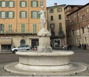
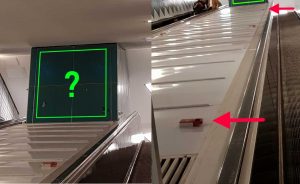
ONE STEP AHEAD Fitness would like to draw attention to visitors and place an advertising at the station “U2 Messehallen”, at the escalator to the “Karolinenstraße – Marktstraße – Hamburg Messe”.
Let’s say that an advertising must be on average for 25 seconds in the field of vision of a person before it is recognized, and that this range of vision here is between the first and penultimate emergency stop. Give the result as a whole percentage (say 25, if your computation is 0.252).
Using escalator speed and exponential distribution as a distribution function, the students can solve the task. In the interview, Mathias Bärtl himself gives an insight into the idea of using MathCityMap for students.
In what context did you use MathCityMap? How did you hear about the project?
I got to know the MathCityMap project in March 2018 at the joint annual meeting of the GDMV in Paderborn. However, as so often not in a presentation, but in a casual conversation with the inventor of the app in the bus on our way to the conference. The combination of digital media, city exploration and work in a team on concrete objects inspired me immediately. I could imagine that even students feel appealed when being challenged with more demanding tasks. For me, this opens up a good opportunity to use contents of the statistics lecture in practical situations and a motivating environment.
What content and competences are used in your trail? Which target group is addressed?
The trail puts the participants – students of business related subjects – in the situation of a project manager, who should prepare the market introduction of fitness equipment. For this purpose, different places of Hamburg must be visited and analyzed under certain questions. My focus during the development was to pick up the contents of the statistics lecture and embed it in a coherent overall story, which at the same time requires the exploration of exciting places. Admittedly, I have not started primarily with the definition of desired competences. Ultimately, however, the tasks developed are to be assigned to mathematical modeling and solution. In terms of content, the areas of probability calculation, estimation and testing, but also correlation and regression are covered.
Have you already tested the trail and received feedback?
I did a test run with two students. It was about a test of the comprehensibility and feasibility of the individual tasks as well as an examination of the temporal approach. Of course, this cannot be considered as a test under scientific aspects. The two participants were extremely motivated and feedback like “It was really fun! I think that it will leave a positive impression on students.” promises that the idea will be well received on a larger scale, and I’m looking forward to offering it as an elective course with an excursion in the future.
We thank you for the interview and the great implementation of the MathCityMap idea in a new context.