Our current task of the week is located in the German Hanseatic city Lübeck. Yvonne Kaiser created the GPS task „Ein Platz für die Statue – Umkreismittelpunkt des Dreiecks“ [„A location for the statue – circumcentre of a triangle”]. In the following she answers us several questions about her task and MathCityMap. Information about the task type GPS task, which can be easily created by using the Task Wizard, can be found here.
How do you get in contact with MathCityMap?
At the moment, I participate in a further training as a mathematics teacher on secondary level. During the training, we should create a MathCityMap math trail about geometric objects.
Please describe your task. Where is it placed? What´s the topic of the task?
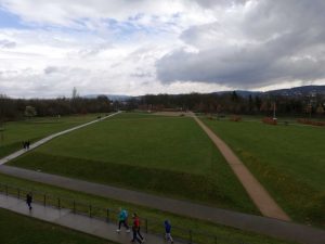
The task formulation is: The statue in front of the building in the Kalkbrenner street should be placed on the school yard, so that the statue has the equal distance to our three school buildings. Find the point, which has the same distance to the three marked points.
To solve this task, the students firstly have to walk to the three marked points. They recognize that those three points are the corner points of a triangle. By using tape measures and protractors the students can determine at least two perpendicular bisectors. The intersection of those two lines is the circumcentre of a triangle, which is the quested point.
Which didactic aims do you want to stimulate through this task?
The aim of the task is to practice the geometric construction of perpendicular bisectors not only on a sheet of paper in the classroom but outdoors on the school yard. As the building behind the statue will be teared down prospectively, the question raises, where the statue will be placed afterwards. Thus, the story in the task formulation awakes further motivation.
Do you have any other commentary on MathCityMap?
Until now, I’ve never used MathCityMap in class. Therefore, I’m really looking forward to try it out and to observe, how students will work on this problem.